That’s right, it stops. While signs continue to mark NJ 7 on Rutgers Street in Belleville, that section of road is not part of NJ 7; instead, it’s merely NJ 506, which used to be co-signed with NJ 7 along the Belleville Pike but is no longer. The “other” part of NJ 7 runs along Washington Avenue in Belleville and Nutley, starting from the Second River on the Newark city line, and then turns left on Kingsland Road. That stretch of highway ends at the Passaic County line where Cathedral Avenue in Nutley becomes Passaic Street in Clifton – again, inexplicably short of NJ 3.
I have not yet met anyone who can explain why NJ 7 is as crazy as it is. However, I can tell you that prior to the 1953 state highway renumbering, the Essex County portion of NJ 7 used to continue southward, down Broadway in Newark, to its intersection with Bloomfield Avenue, then part of NJ 23, now NJ S-506. And I have several maps that indicate a Passaic County continuation of NJ 7, up Passaic Street and then left on Main Avenue to old NJ S-6 (which ran through Paterson before the completion of today’s US 46).
In addition, prior to 1953 the Belleville Turnpike may – or may not – have been designated NJ 9. The number definitely applied to today’s NJ 506 between NJ 6 in Pine Brook and NJ 7 in Belleville, and some (but not all) old maps show NJ 9 continuing across Arlington and through the meadows. The NJ 9 designation was discarded in the 1953 renumbering, at which time numbers that duplicated US highway numbers were discarded. All that makes sense. I simply cannot explain why the state never commissioned (or re-commissioned) the short stretches of Rutgers Street and Passaic Street that would logically complete NJ 7.
In keeping with the Bergen County focus of this site, only the section of NJ 7 that borders North Arlington is listed. The mile markers begin at the road’s origin in Jersey City.
| Mile | Street Name | Feature (South to North) |
| 3.72 | Entering (Kearny Town, Hudson Co.) [North Arlington Boro, Bergen Co.] | |
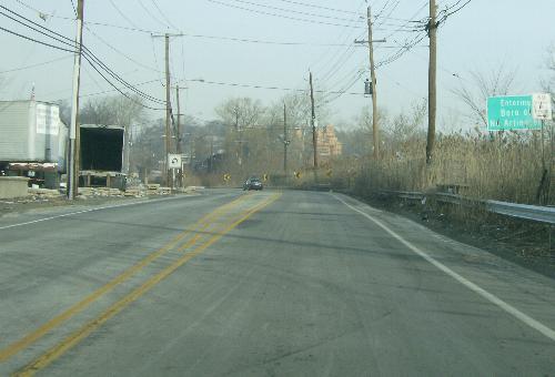 Westbound on the Belleville Pike, approaching Saw Mill Creek and entering Bergen County. | ||
| 3.72 | Belleville Tpk | Saw Mill Creek {culvert} |
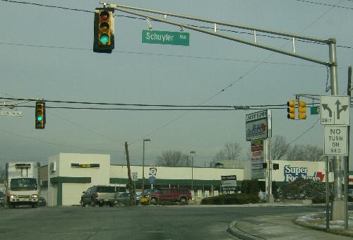 Westbound at the Schuyler Avenue signal. | ||
| 4.22 | Belleville Tpk | Schuyler Ave, (Hudson |
| 4.22 | Next 1.00 mile co-signed with |
|
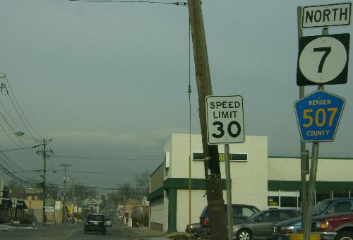 The east edge of the NJ 7/CR 507 concurrency, looking west. | ||
| 4.35 | Belleville Tpk | Elm St {signal} |
| 4.74 | Belleville Tpk | (Kearny Ave, Hudson |
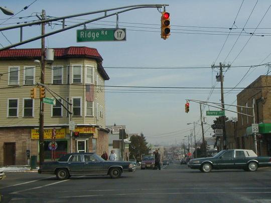 NJ 7 looking eastbound at intersection with NJ 17’s southern terminus. | ||
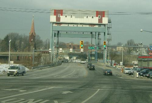 Looking westbound at the drawbridge. Section 1 of NJ 7 ends at the west edge of the drawbridge, just past the county line. CR 507 turns right at the signal. | ||
| 5.22 | Belleville Tpk | (Passaic Ave, Hudson |
| 5.29 | Belleville Tpk | Passaic River {bridge} |
| 5.29 | Entering Belleville Twp, Essex Co. | |