A unique feature occurs at the Hackensack-Maywood line. To the south, you see Coles Brook flowing under a bridge; but to the left, you see a street called The Esplanade. The wide street was built atop a conduit carrying the brook to Passaic Street, CR 62, where it re-emerges.
Bergen County now considers Railroad Avenue in Saddle Brook and Rochelle Park, the former CR S-61, to be part of CR 44. As a result, CR 44 now overlaps CR 61 for a little less than a quarter-mile.
The official NJDOT straight-line diagram inventories CR 44 from east to west, but I have reversed it for consistency.
| Mile | Street Name | Feature (West to East) |
| 0.00 | ||
| 0.00 | Railroad Ave | Saddle River Rd |
| 0.03 | Railroad Ave | Saddle River {bridge} |
| 0.03 | Entering Rochelle Park Twp | |
| 0.17 | Railroad Ave | Rochelle Ave |
| 0.17 | ||
| 0.39 | ||
| 0.39 | Central Ave | Rochelle Ave |
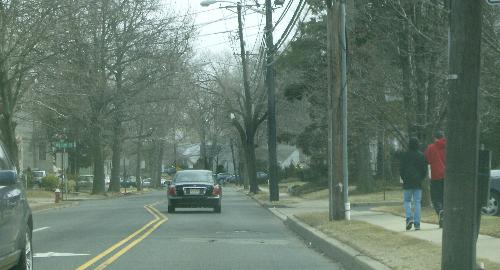 Central Avenue just east of Rochelle Avenue. | ||
| 0.73 | Central Ave | |
| 0.74 | Entering Maywood Boro | |
| 0.84 | Central Ave | Unnamed stream {bridge} |
| 1.18 | Central Ave | Maywood Ave |
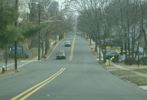 Central Avenue eastbound approaching the Esplanade and Coles Brook. | ||
| 1.59 | Central Ave | Coles Brook {bridge} |
| 1.59 | Entering Hackensack City | |
| 1.81 | Central Ave | Summit Ave |
| 1.90 | Central Ave | Prospect Ave {signal} |
| 2.18 | Central Ave | 1 St |
| 2.33 | Central Ave | Erie Railroad {at-grade crossing} |
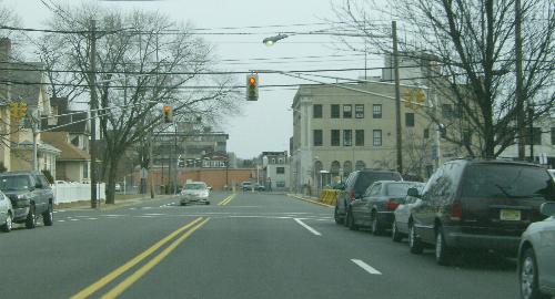 Approaching Union Street, with State Street beyond. | ||
| 2.48 | Central Ave | Union St {signal} |
| 2.57 | Central Ave | State St {signal} |
| 2.57 | ||