A unique feature occurs at the Hackensack-Maywood line. To the south, you see Coles Brook flowing under a bridge; but to the left, you see a street called The Esplanade. The wide street was built atop a conduit carrying the brook to Passaic Street, CR 62, where it re-emerges.
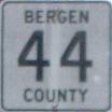
The official NJDOT straight-line diagram inventories CR 44 from east to west, but I have reversed it for consistency.
| Mile | Street Name | Feature (West to East) |
| 0.00 | CR 44 BEGINS, Rochelle Park Twp | |
| 0.00 | Central Ave | Rochelle Ave, CR 61 {signal} |
| 0.34 | Central Ave | NJ 17 {underpass} |
| 0.35 | Entering Maywood Boro | |
| 0.45 | Central Ave | Unnamed stream {bridge} |
| 0.79 | Central Ave | Maywood Ave, CR 59 {signal} |
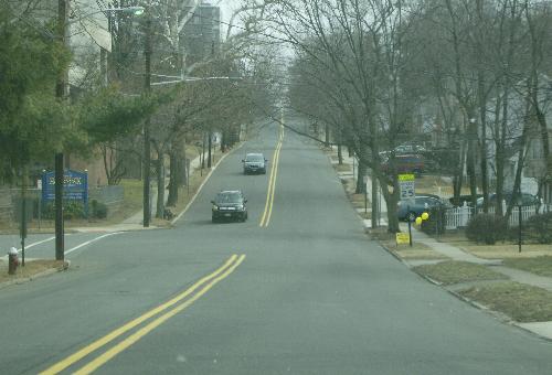 Central Avenue eastbound approaching the Esplanade and Coles Brook. | ||
| 1.20 | Central Ave | Coles Brook {bridge} |
| 1.20 | Entering Hackensack City | |
| 1.42 | Central Ave | Summit Ave, CR 57 {signal} |
| 1.51 | Central Ave | Prospect Ave {signal} |
| 1.79 | Central Ave | 1st St, CR 55 {signal} |
| 1.94 | Central Ave | Erie Railroad {at-grade crossing} |
| 2.09 | Central Ave | Union St {signal} |
| 2.18 | Central Ave | State St {signal} |
| 2.18 | CR 44 ENDS, Hackensack City | |